On the 2nd of February, the Cape Agulhas Wetlands were designated as a UNESCO Ramsar Site of International Importance. This 32nd Ramsar Site of International Importance is situated within the Cape Floristic Region, a UNESCO World Heritage Site. The Ramsar site encompasses the extensive, diverse plains of the southernmost tip of Africa, with the Atlantic Ocean in the west and the Indian Ocean in the east. The Agulhas Plains is a low-lying coastal plain, with some areas below sea level. The landscape includes dunes, limestone hills, and cliffs. The highest point is in the Agulhas National Park at 309m within the Waterford Section.
These characteristics support several diverse wetlands, such as Soetendalsvlei, the second-largest freshwater lake in South Africa. The lake is within the Estuarine Functional Zone of the De Mond Estuary Ramsar Site. The greater part, which is managed by Agulhas National Parks (SANParks), and a small portion of the Soetendalsvlei is managed by CapeNature.
The site is also within the Fynbos biome of the Greater Cape Floristic Region, a Key Biodiversity Area. It is included in the UNESCO Cape Floristic Region World Heritage Site due to its natural biodiversity and ecological processes.
The Site includes more than:
- 960 plant species,
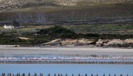
- 144 bird species,
- 68 mammals,
- 33 amphibians,
- 8 fish species.
A large number are endemic, highly threatened, and dependent on wetlands. The 23 984 ha Ramsar Site supports the highest diversity of wetlands within South Africa, with a total of 8 127 ha.
Along the west of the Ramsar Site is the Ratel River flowing to the Ratel River estuary. It forms a floodplain wetland higher upstream, where rehabilitation near the historic Ratel Rivier homestead has restored its hydrological functioning. The Waterford section preserves the waters of three rivers. Several channelled valley-bottom and depression wetlands occur throughout the site. The water quality differs from fresh to brackish and saline.
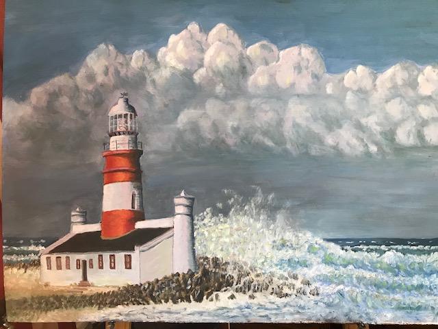
The site has significant cultural value due to its Khoisan heritage (stone tools), rich maritime history (shipwrecks, iconic lighthouse since 1949), and remnants of early European settlements.
Overall, the site is in a good ecological state, but it is threatened by surrounding agricultural activities, intruder species, road infrastructure, and potential renewable energy developments. A site-specific management plan is being implemented to address the issues and to ensure the site’s long-term conservation and use.